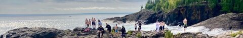
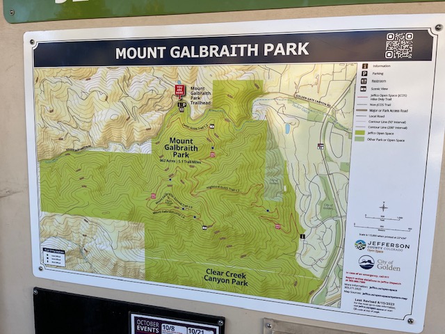
Jefferson County, Colorado is home to many scenic mountain hikes. With over 275 miles of trails, 75 parks, and 58,000 acres of open space to enjoy, there is something for everyone. For a commanding view of Denver, the Continental Divide, and downtown Golden, Colorado, consider a hike on the Galbraith Loop Trail just outside of downtown Golden. The Galbriath Loop Trail ascends to 7,260 feet via Cedar Gulch, forming a loop near the peak of Mount Galbraith. See map below from Topozone.com of the Galbraith Loop and surrounding area.

Note: This post contains affiliate links. If you choose to make a purchase based on my recommendation, I may earn a small commission at no additional cost to you.
Galbraith Loop Trail Location and Directions
Mount Galbraith Park is located just under 3 miles (about an 8 minute drive) northwest of downtown Golden, Colorado. To access the Cedar Gulch trailhead from downtown Golden:
- Drive on 6th Avenue to merge with 19th Avenue
- Follow 19th Avenue to Golden Gate Canyon Road
- Turn right on Golden Gate Canyon Road
- Drive about 1.4 miles to the trailhead at 21992 Golden Gate Canyon Road
Galbraith Loop Trailhead Access & Details
- Trail length: 4-4-5 miles; 1.6 miles surrounding Mount Galbraith peak
- Difficulty: Moderate
- Elevation: 921 feet
- Time: 2-3 hours
- Dogs permitted: Yes; leashed
To access the Galbraith trail, park at the Cedar Gulch trailhead at 21992 Golden Gate Canyon Road. The entire hike via the Cedar Gulch trailhead is about 4.3 miles, and the loop of the Mount Galbraith peak itself is 1.6 miles long. This is a hiker only trail with 921 feet of elevation, views of downtown Golden and the famous Coors Plant, Table Mountain (North/South) and the Front Range.
From the trailhead, you can hike the loop clockwise or counterclockwise. If you’re looking for a more gradual incline, hike clockwise from the trailhead; for a steeper start, hike counterclockwise.


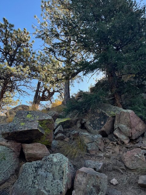
Galbraith Loop Trail Conditions and Cautions
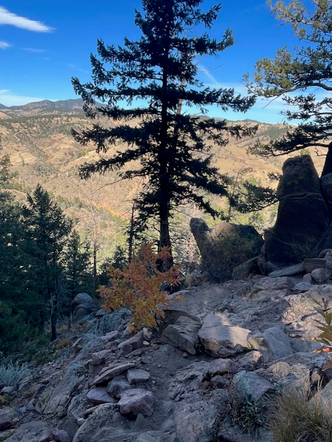
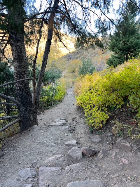
The trail is rocky and steep in some sections, with exposed roots, stone stairways, and occasional scrambles in steeper sections. Additionally, there are a few narrow spots as you ascend the trail. Rattlesnake season in Colorado is between late March/early April (when snakes emerge from hibernation) through October, so it’s important to be aware of their potential presence in open areas and rocky spaces along the trail. I was fortunate not to encounter a rattler on my hike; however, rattlers are sometimes spotted on the trail, so use caution and keep dogs on leash!


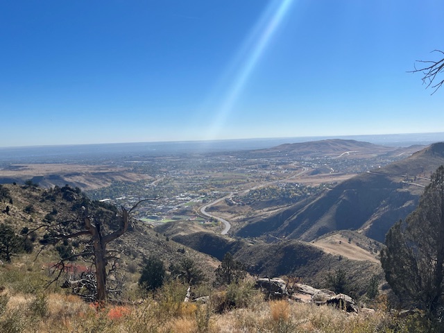
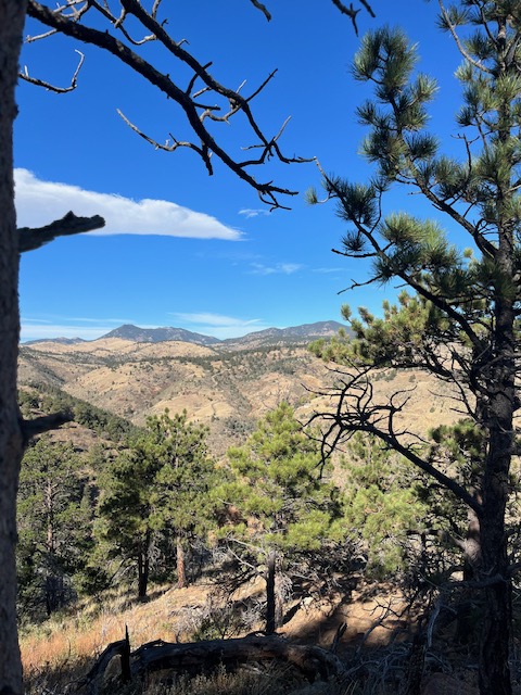
Galbraith Loop Views
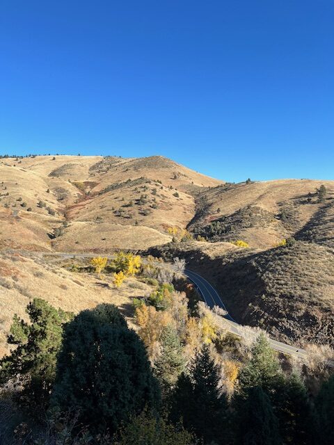
The Galbraith Loop is wide open for the most part, offering views in all directions. To the east, you’ll enjoy views of downtown Golden and the Coors Plant. To the west, enjoy views of Golden Gate Canyon and Halfmile Gulch.


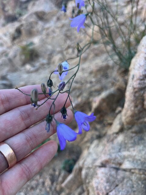
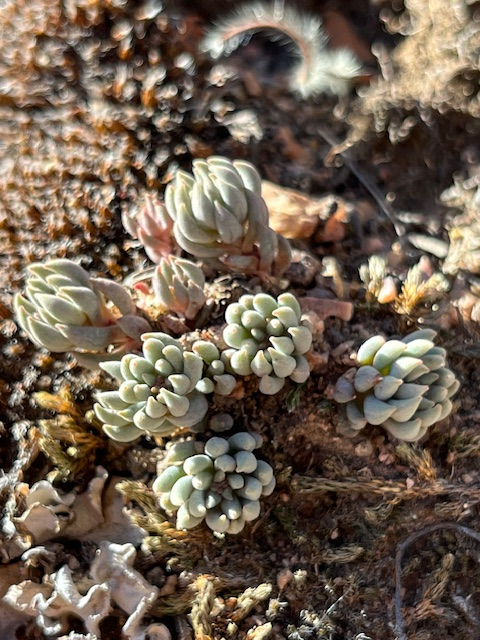
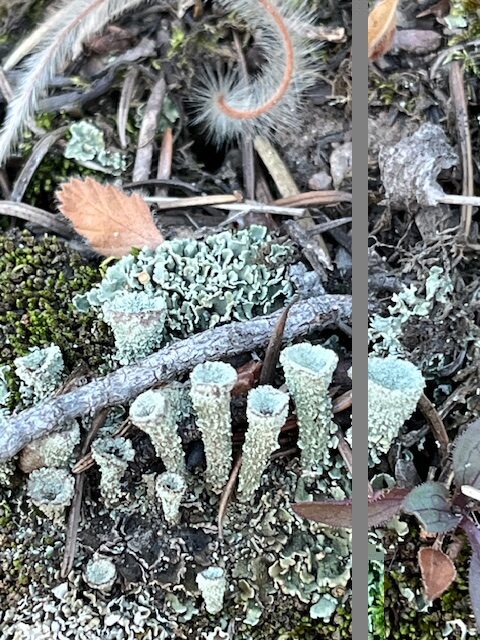
Plants, Lichens, and Shrubs of the Galbraith Loop
I am familiar with native plants of the Great Lakes region, but during my hike on the Galbraith Loop I discovered many beautiful native plants, shrubs, and lichens different from what I observe at home. Some common native plants in Golden and the surrounding region include prairie sagewort, sedum (a succulent), wild buckwheat, mountain mahogany, harebell, and numerous unique lichens such as the pixie cup lichen pictured below.


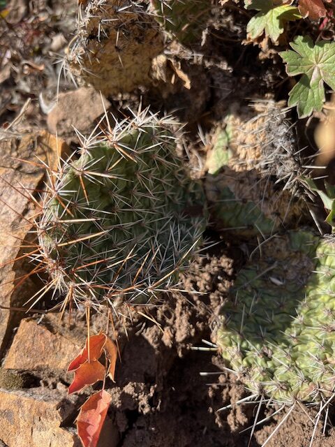
Plains Prickly Pear Cactus
A common cactus on the Galbraith Loop, and much of Colorado, is the Plains Prickly Pear. Abundant in the western and southwestern United States, this cactus blooms with bright yellow flowers up to 6 inches wide. The plants were not in bloom during my October hike, but I would love a return visit to find them in bloom. Learn more about the Plains Prickly Pear Cactus at the U.S. Forest Service.

Golden, Colorado Weather
Weather in the Golden area ranges from low 20s to mid-80s throughout the year, with four distinct seasons and over 300 days of sunshine each year on average. I last hiked here in mid-October, and it was warm and sunny in the mid-60s.
For a current forecast and weather conditions, check Denver’s National Weather Service website for real-time updates.
Galbraith Loop | AllTrails
For detailed information on the Mount Galbraith Loop and Jefferson County, Colorado’s many scenic trails, explore AllTrails. Search 500,000+ trails by state and trail type, with photos, maps, and detailed trail reviews.

Explore Downtown Golden
After your hike of the Galbraith Loop, take a bit of time to explore the shops of downtown Golden, or stop for a meal at one of many restaurants. Be sure to check out the quilt store on Washington Street (Gallerie Quilt) to say hello to the two beautiful Saint Bernards who watch over the shop. I’ve shared a few images of downtown Golden below.


Clear Creek
In downtown Golden, be sure to take a stroll along the scenic Clear Creek via the Clear Creek Trail. This point-to-point trail is 18.8 miles in length, with a section passing through downtown Golden. This trail is popular with runners, bikers, and birders, offering different view of Golden.


Scenic Hikes in Colorado and New Mexico
For more information on similar adventures in Colorado and neighboring New Mexico, read more in my recent articles linked below. Articles include hiking Great Sand Dunes National Park, Capulin Volcano National Monument, and scenic hikes in New Mexico’s Santa Fe National Forest. Come explore with me!


June 9, 2025 by Erin
Immerse yourself in an environment that looks and feels like a foreign planet – visit Great Sand Dunes National Park, at the base of the Sangre de Cristo Mountains in southern Colorado. Great Sand Dunes offers the unique experience of standing amidst a vast dune field, the tallest in North America!
Immerse yourself in an environment that looks and feels like a foreign planet – visit Great Sand Dunes National Park, at the base of the Sangre de Cristo Mountains in southern Colorado. Great Sand Dunes offers the unique experience of standing amidst a vast dune field, the tallest in North America!
Enjoy Your Visit to Golden!
Jefferson County, Colorado and the town of Golden are well worthy of a visit, exploration and scenic hikes. Enjoy a day or a week in Golden, and this beautiful mountain hike.
-Erin

I spent some time in Golden when I was a truck driver and I can say that it was breathtaking to say the least..
It’s a gorgeous part of CO!⛰️
Indeed it is